


A Day in the Life of Africa
On February 28th 2002, 95 photographers photographed 26 countries in Africa over 24 hours. Features work by photographers from Magnum, VII, Reuters and Contact Press Images.
Africa - Maps
Stanford University Libraries/Academic Information Resources
Africa Focus: Sights and Sounds of a Continent
University of Wisconsin-Madison Libraries provides digitized images and sounds from dozens of African countries.
Africa Map Quiz
Learn the names and locations of countries in Africa. Requires Flash plugin.
Africa: Maps and Satellites
Features weather, earthrise, and meteosat images, and NSSDC photo gallery.
African Geography, Maps and Information
Countries and maps of Africa, including satellite images.
African Imagery
Various photographers show their artwork with personal image galleries from Africa.
Antique Maps of Africa and South Africa
Antique maps of Africa and South Africa from the sixteenth through the nineteenth century.
Guide to Maps of Africa
Pathfinder and guide to maps of Africa held at the Indiana University Geography and Map library.
Hans Hendriksen
Offers travel images from South Africa, Lesotho, Swaziland, Zambia and Morocco.
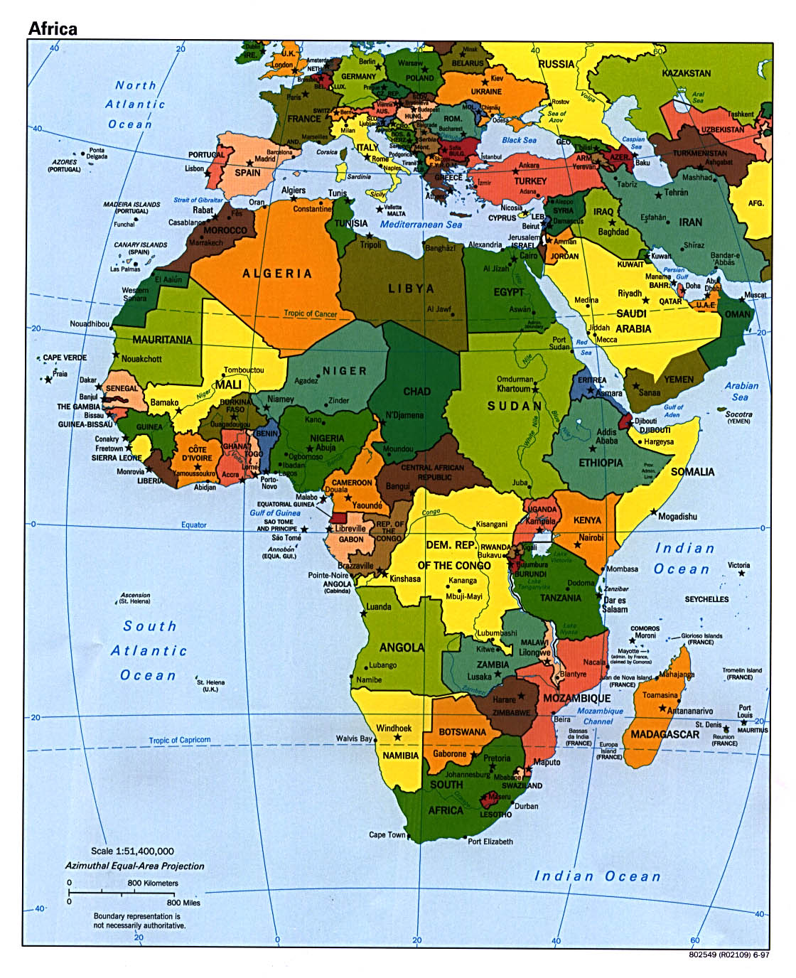
Map of Africa
Azimuthal Equal Area Projection. 1997. (349K)
ReliefWeb Map Centre - Africa
Maps categorized by country, resource and issue.
Safari enthusiast
Does offer travel images from Kenya, Tanzania, Bostwana, Namibia, South Africa, Zambia and Zimbabwe.