


Images of Portugal
1300 photographs of Portugal, Madeira and the Azores by Miguel Torres, arranged by district and by alphabetically by place. Access via sensitive map or list.
Lonely Planet: Portugal Map
Map of mainland Portugal showing principal cities.
Map 4 Travel: Portugal
Interactive map showing districts, major cities, airports, attractions and hotels.
Map of Portugal
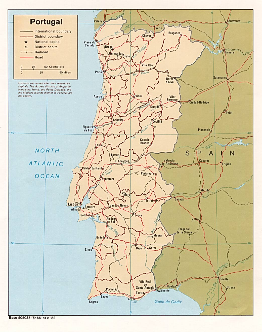
Expandable map of 1982 showing district boundaries, railiways and roads, from the Perry-Castañeda Library Map Collection.
Portugal Book
Galleries of expandable thumbnail photographs by Pedro Correia of places in Portugal, particularly historic buildings and beaches.
Portugal Photo Gallery
A collection of 285 photographs of places in Southern and Central Portugal taken by Molon in April 2002.
Shaded Relief Map of Portugal
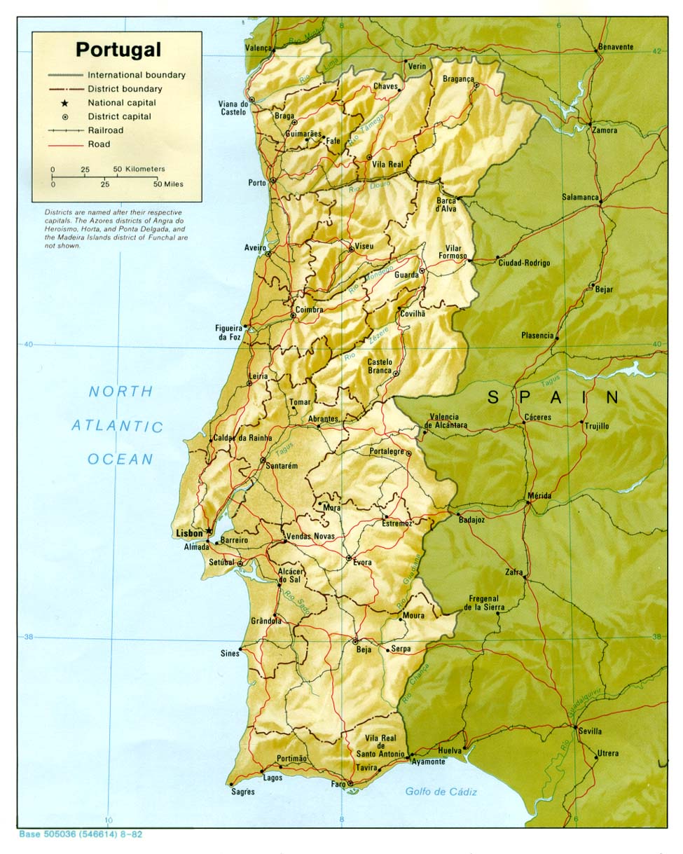
Expandable relief map of 1982 showing district boundaries, railways and roads, from the Perry-Castañeda Library Map Collection.