


Alovelyworld.com: Lebanon
Includes various photographs from Beirut, Sidon, Tyre, Beiteddine, Baalbek, Kadisha, Tripoli and Byblos.
Anthony Wehbe's Picture Gallery
Photographs of Miziara, Qadisha Caves, Cedars, and Baalbeck.
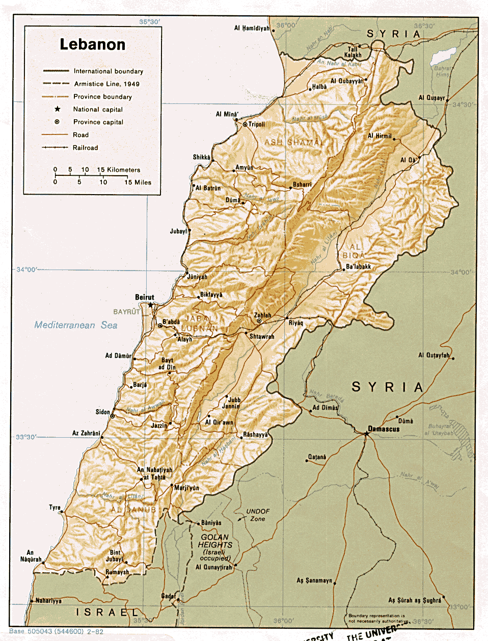
Contour map of Lebanon (detailed)
Mountains, major cities, roads, rail roads, various boundaries.
Lebanon Gallery
Photographs categorized by location. Includes forum and related links.
Lebanon Maps
1:200,000 Arabic and English language maps of Lebanon courtesy of Ministry of Tourism and "Next Vision".
Lebanon Maps / Beirut Maps
A number of Lebanese and Beirut capital maps. Part of the Perry-Castaneda Library maps at the University of Texas at Austin.
Lebanon Panorama
Presents 360-degree panoramic views of Lebanese destinations. Virtual trips to various cities.
Lebanon Tour Photo Album
Offers galleries of photographs from various places in the country.
LebanonArt Panoramic
Presents 360-degree panoramic views of Lebanese destinations.
National Geographic map of Lebanon
By the Cartographic Division of National Geographic Magazine in association with GeoSystems Global Corp.
Pictures from the Lebanese landscape by Fareed Abu
Extensive gallery of the Lebanese environmentalist Fareed Abu Haidar brought through "AlMashriq - Levant".