


Historical Topological Map
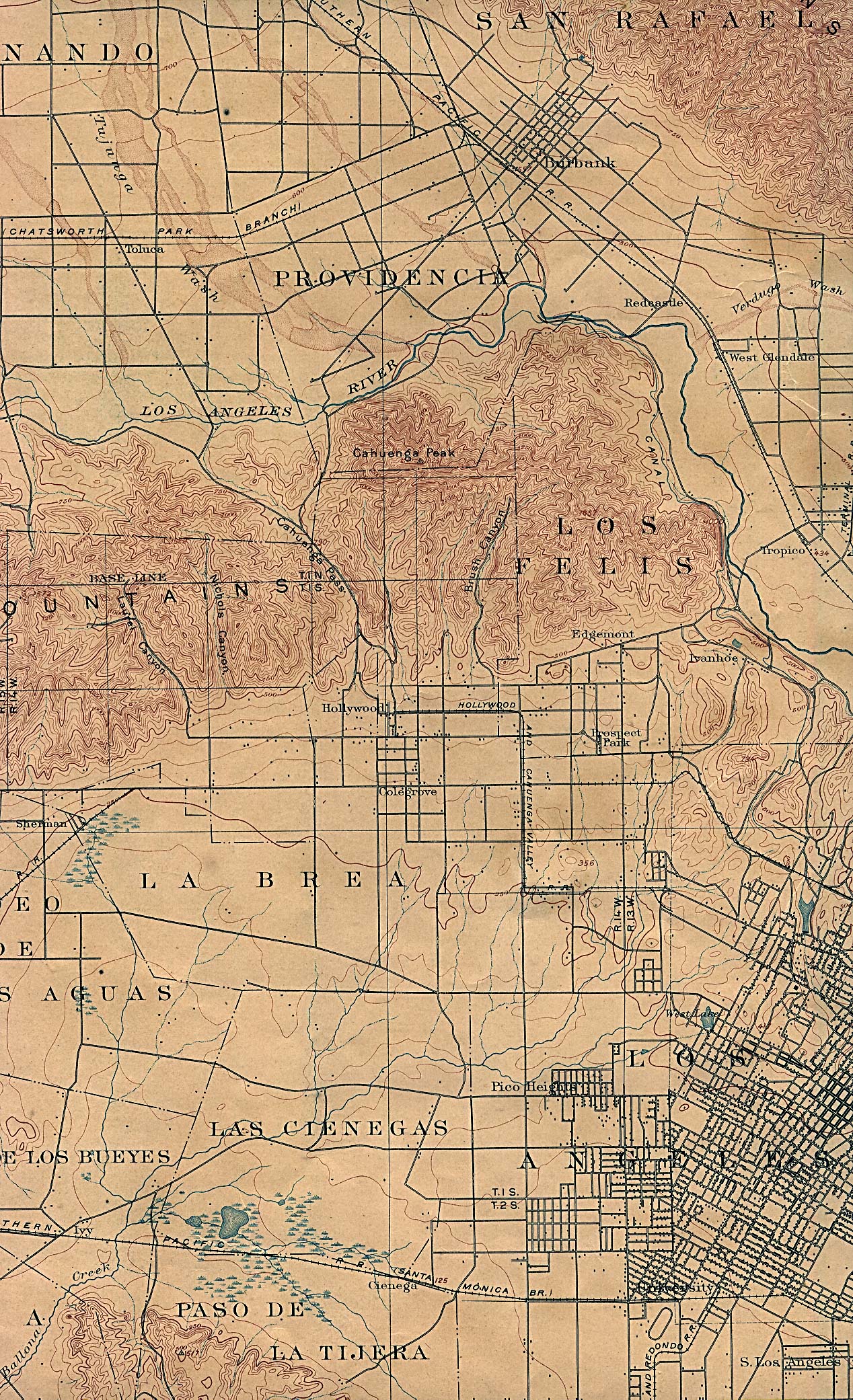
USGS map from 1902, including parts of Los Angeles, Burbank, and Hollywood. (1,097K)
Historical Topological Map
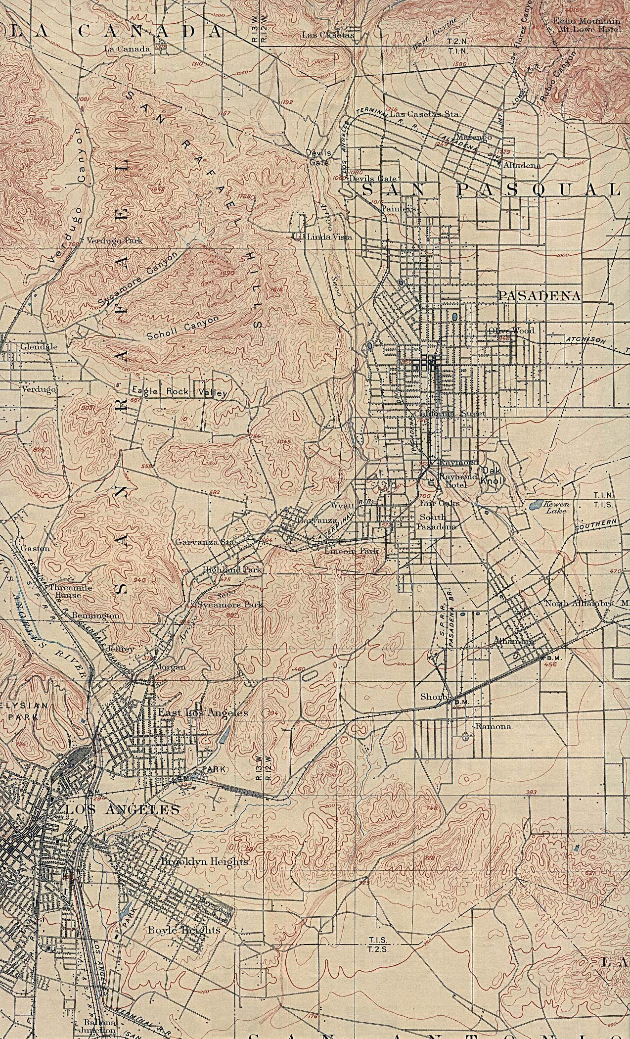
USGS map from 1900, including parts of Los Angeles and Pasadena. (1,063K)
Historical Views of Los Angeles Area
Bird's-eye view of Los Angeles in 1877, including separate views of Wilmington and Santa Monica.
LAPhotos.com
Offers photos and slideshows from Los Angeles and Southern California.
Los Angeles
A virtual photo tour through the streets and beach fronts of the area.
Metropolitan Los Angeles and Vicinity
Atlas project provides a map of the area and communities.
Points of Interest Map
Shows major highways, communities and points of interest in Los Angeles County. Provided by the California Division of Tourism in pdf format.
The Virtual L.A. Project
Preview UCLA's project to build a 3-D computer model of the entire Los Angeles basin.
Virtual Canvas
Thomas Mannfred Carlsson offers a photographic essay of L.A. County, from the Santa Monica beach, to Hollywood, to the Staples Center to the center of downtown.